Want more ways to integrate your workspace with ArcGIS Online and perform analysis in one application? Want to enrich your data with demographics, create service areas for facilities, or get driving directions from one point to another? FME has got you covered in delivering spatial analysis capabilities and integrating with outside applications such as ArcGIS Online. Read on and find more ways to integrate with FME Hub custom transformers that are being uploaded and updated every day!
What is ArcGIS Online?
ArcGIS Online (AGOL) is Esri’s cloud-based mapping software that lets you build interactive web maps. They provide analysis tools, such as the Routing Service, Geocoding, etc., to gain location intelligence. ArcGIS Online enables you to work effectively across your organization by collaboratively building and using maps that you can share within your organization or publicly. You can also use the ArcGIS Online REST API to publish data, a good use case for this is Iowa DOT: Preparing Data for APIs.
What are FME Hub Custom Transformers?
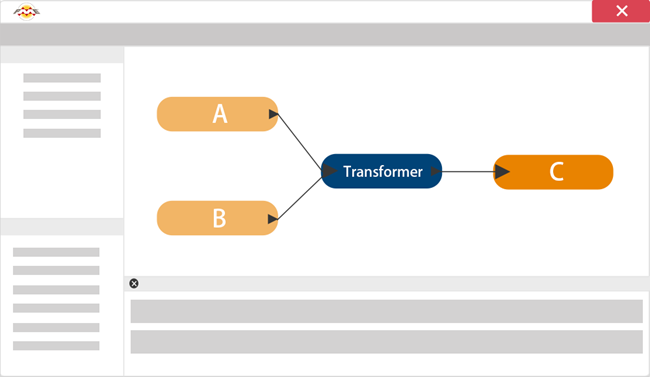
A custom transformer is made up of many regular transformers that are bundled together to simplify your workspace and make it less complex to the eye. Many custom transformers are made by Safers to make the data integration easier, but you can make your own custom transformers too! You can find and publish your own custom transformers on the FME Hub.
What is a REST API?
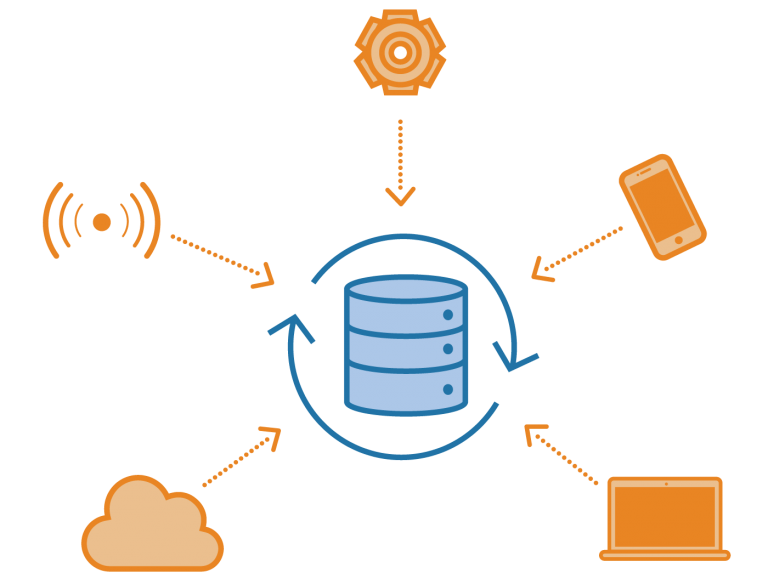
API (Application Programming Interface) is a software intermediary that allows two applications to talk to each other over the web. The REST API allows the use of HTTP requests to access and use data such as read, update, or even create by calling a GET, PUT, or a POST method. You can create your own custom REST API workflows using the HTTPCaller with authorization with a token or a web connection! See Web Connections and FME article for more information. We continue to develop and publish API-based connector FME Hub Custom Transformers. While there are thousands of systems out there, we don’t always know what is being widely used in industry. Feel free to contact us to let us know what you are interested in connecting to!
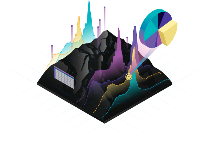
What can FME do?
FME is the data integration platform with the best support for spatial data. It allows organizations to migrate data from over 450 sources, including geospatial systems. Within the workflows, organizations can integrate, convert, and cleanse datasets before they’re integrated into the target system. FME uses transformers to perform these translations and analysis workflows in a no-code solution.
These transformers can include calling other services and integrations such as ArcGIS Online Services in determining service areas, network routing, geoenriching with demographics, or geocoding.
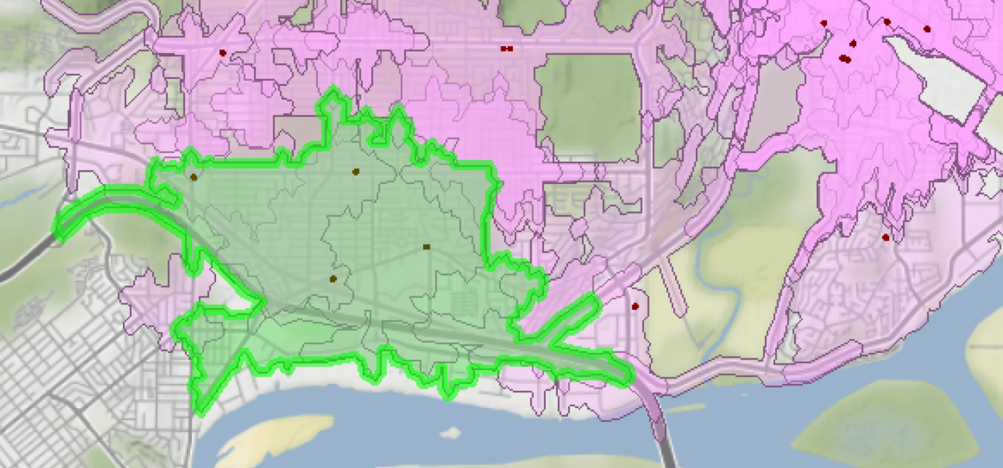
1. Drive-Time Service Areas
The ArcGIS Online Service Area Calculator is a service provided by Esri that calculates the drive time by minutes or distance from a network analysis. This is especially useful for those wanting to know what is within a service area of a facility, or what falls outside of multiple service areas (i.e. what is being underserved). The ArcGISOnlineServiceAreaCalculator transformer is used to find the area that can be reached from the input location within a given travel time or travel distance using the ArcGIS Online REST API. For more information on how to use this custom transformer, see the Using the ArcGISOnlineServiceAreaCalculator article. Check out an excellent use case for this transformer with the Food Desert Analysis Using ArcGIS Online and FME article.
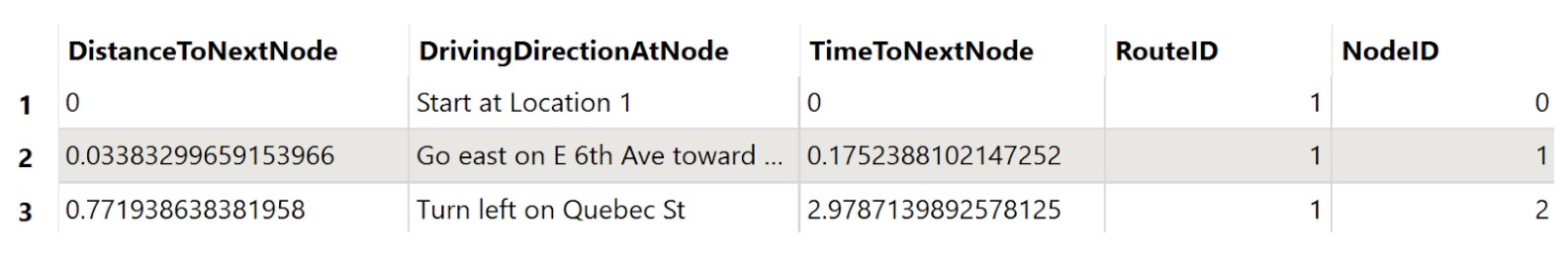
2. Directions
The ArcGIS Online Routing Service is used to find the best way to get from one location to another or to visit several locations using the ArcGIS Online REST API. The ArcGISOnlineRouter custom transformer provides directions and routes you through each of your points of interest. This service is especially helpful for the traveling salesman problem (TSP) where there are many places to visit along the same route in the shortest amount of time or shortest distance. For more information on how to use this custom transformer, see the Using the ArcGISOnlineRouter article.
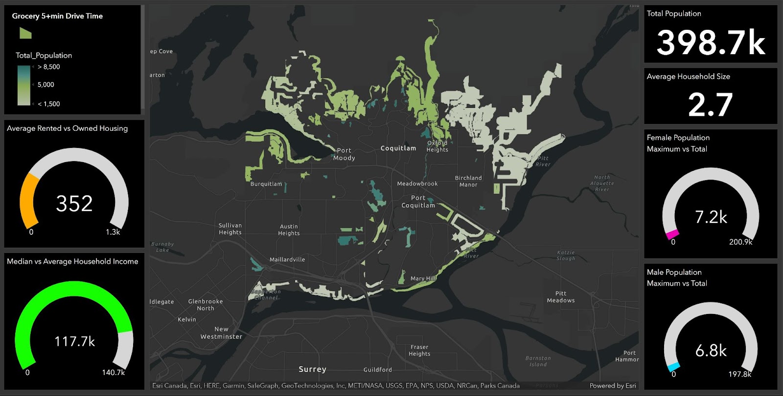
3. Enriching your Data
The ArcGIS Online GeoEnrichment service is provided by Esri to give demographic information of specific points in your area. Enriching your data is useful for visualizing and analyzing your information in new ways, such as an ArcGIS Online Dashboard! The ArcGISOnlineGeonricher custom transformer finds demographic information and other location facts for places around the world using the ArcGIS Online REST API. For more information on the GeoEnrichment service and the use of the ArcGISOnlineGeoenricher, see the Using the ArcGISOnlineGeoenricher article. Check out excellent use cases for this transformer with the Food Desert Analysis Using ArcGIS Online and FME article and the Enhancing Excel Data and Publishing to ArcGIS Online demo.
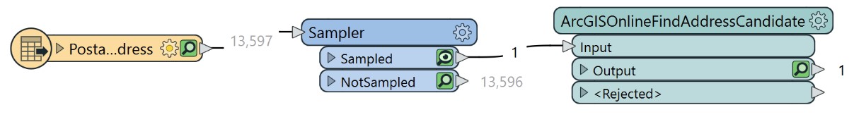
4. Determine Points from Addresses
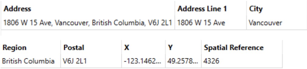
The ArcGISOnlineFindAddressCandidate transformer uses the ArcGIS Online (AGOL) REST API to geocode addresses one location per request; the input address can be combined into a single input field or divided among multiple parameters. For more information on how to use this custom transformer, see the Using the ArcGISOnlineFindAddressCandidate article. Check out the excellent use case of geocoding in the Enhancing Excel Data and Publishing to ArcGIS Online demo.
Need to geocode batches of addresses (1-1000)? Maybe the Batch Geocoder would work best for you. See the difference between all of the geocoders at this article: Q&A: ArcGIS Online Geocoders. The different ArcGIS Online geocoder transformers are: the ArcGISOnlineBatchGeocoder, the ArcGISOnlineFindAddressCandidate, and the standard Geocoder.
Next Steps
We need your valuable feedback on what systems you need connections to and how you intend to use them. Whether you’re building your first workspace with the updated and recently added ArcGIS Online custom transformers or planning to migrate to a new business system with an API, we’re always happy to learn from you on how you intend to use FME in your project. Never hesitate to keep the conversation going, email us at info@safe.com. We’re here for you!
Additional Resources
- Getting started with ArcGIS Online and Portal
- Quick Tips for ArcGIS Online frequently asked questions
- Webinar: A Guide to Integrating with the ArcGIS Enterprise
- Food Desert Analysis Using ArcGIS Online and FME
- Automatically Enhancing Excel Data and Publishing to ArcGIS Online

Evie Lapalme