What is Europe’s INSPIRE Directive? What is INSPIRE data? How does it all work?
The European Union (EU) unites 27 member-states under an ethos that collective decision-making and cooperation contribute to a greater common good. This is especially relevant when addressing environmental challenges, where we are all participants and stakeholders.
It’s with good reason that the first law of ecology is “Everything is connected to everything else.” Imagine a single upstream factory dumping waste into a river. The pollutants are carried across several borders, flow through farmers fields, until it drains into a reservoir. After getting pumped and routed to a local water main, an unsuspecting person pours a glass of that contaminated water. Environmental impacts do not stop at borders, and neither does the data.
However, Europe’s many borders have long acted as a barrier for data exchange. Different standards, formats, languages, and laws are just some of the obstacles that prevent the free exchange of information. Accessible and usable data (particularly spatial data) is critical for developing policy that can address the complexities of an interconnected environment.
The EU developed the Infrastructure for Spatial Information in Europe (INSPIRE) directive to solve many of these data challenges. The INSPIRE initiative aims to provide the infrastructure and guidelines for creating and maintaining spatial data related to the management of the natural environment and its societal impacts.
What is Europe’s INSPIRE Directive?
INSPIRE is a legal framework set forth by the EU to standardize geospatial information so that it is accessible and available for sustainable development, public administration, public safety, and environmental decision-making. A unified approach to spatial information empowers governments, organizations, and citizens to develop meaningful and comprehensive environmental policies.
Europe’s INSPIRE directive is guided by five common principles that, ultimately, aim to make spatial data as useful as possible.
INSPIRE data is…
- Transparent: Data for governing should be easily found and freely available.
- Accessible: Disparate data sources can be easily combined, no matter its origin.
- Scalable: Data is structured so that it can be used across different scopes.
- Reliable: Data is collected only once and is maintained regularly.
- Accountable: Metadata is formalized and set to a standard.
How Does INSPIRE Work?
INSPIRE began in 2001 with several years of public consultations. During this inquiry period, participants identified common obstacles organizations faced when using spatial data in their work, some of which may be painfully familiar.
Some of the noted challenges were lack of reference data, missing documentation, gaps or duplications, poor quality, language barriers, lack of access or funding, and the enormous, often formidable, abundance of different data formats and structures that we use to describe the world around us.
With these challenges in mind, goals were set, and solutions were implemented. This is where the INSPIRE directive comes in.
The EU is not the first regional body to create a standard data framework. The INSPIRE directive is a relatively ambitious example of a spatial data infrastructure (SDI). Examples of other SDIs have been created by many nations and groups including Canada’s (CGDI), Northerly nations’ (Arctic SDI), the United Nations’ (UNSDI), and a Latin-Caribbean alliance (GeoSUR). Abiding with an SDI is mutually beneficial. Every participant follows the same set of “rules” for creating, managing, sharing and using spatially referenced data.
INSPIRE was officially adopted and enacted into law by European Commission, Parliament, and Council in 2007. The initiative has gone through various implementation stages, facing challenges and adapting along the way. The full realization of the initiative is slated for 2021.
What “INSPIRE Data” Actually Is
The INSPIRE initiative is an example of an open standard for data. That is, it is a formal, published specification for a data model and services. Importantly, it is independent of any platform and can be used by anyone.
So what does INSPIRE data actually look like? Its definition is somewhat twofold: first, there is a framework for using data and second, a defined data model.
This means INSPIRE data is not limited to a singular, defined data format within itself. It is a roadmap for metadata, interoperability, network services, sharing, monitoring, reporting, and a data model. By participating in open standards, data is made interoperable and available to many systems. It encourages collaboration and ensures data is up to an expected quality level.
The Data Framework
Guided by the five principles, member states created an infrastructure for creating, using and maintaining spatial data. This includes metadata specifications, network services, maintenance and collection procedures, and how the data should be shared, accessed, and used.
INSPIRE enlisted the help of domain experts to identify data specifications for different environmental subjects. 34 themes define a range of spatial phenomena: natural risk zones, transportation networks, geology, and species distribution are just some examples. The data models are not one-size-fits-all. They are easily extended for further specification. The themes are contained within broader, geographic categories: reference systems (Annex I), topography (Annex II), and social, natural or statistical datasets (Annex III).
The Data Model
The established INSPIRE data models adhere to an encoding used in the format called OGC Geographic Markup Language (GML).
GML is an XML-based encoding standard designed for modelling information about geographic features in plain text. Text offers a simple and accessible medium: it’s easy to inspect and make changes. Inside GML, geographic features are described by their properties and geometries. This can be quite simple, like representing a tree with a single point feature, or incredibly complicated, like a forest represented by many-nested features of trees, rocks, streams, and hills.
GML provides the language to describe all aspects of geographic features and the flexibility to combine them in different ways. For example, describing hydrography is quite different from a utility network, so each of INSPIRE’s 34 themes has a GML model that accounts for unique features, properties and geometries.
Collectively, the 34 GML models constitute the INSPIRE GML profile. A GML profile is a departure from your run-of-the-mill GML. It may look and feel like GML, but the data model is highly specialized and customized for its application. It might be helpful to remember that GML is a language, not a data format. So, just like I may be able to read and write English, that doesn’t necessarily mean I will understand a Physics textbook. Because of this, working with a GML profile requires a deeper knowledge of its specifications (in this case, INSPIRE). Other examples of GML profiles are CityGML, OS MasterMap, German NAS, and Top10 GML.
Just as XML intends to simplify data transfer and storage on the web, GML makes geographic information available in the same way. This simple approach makes Europe’s INSPIRE directive accessible to the people it is intended to reach.
The GML standard is stewarded by the Open Geospatial Consortium (OGC) and International Organization for Standardization (ISO). Its mission to maximize data interoperability, ease extensibility, and facilitate web-interchange aligns well with INSPIRE’s five common principles.
Making Data INSPIRE Compatible
Rules aren’t very helpful unless everyone follows them. INSPIRE is both binding and legal so that the data is (in theory) guaranteed to be compliant. Implementing Rules (IR) are the regulations for applying the standards for metadata, interoperability, services, sharing, monitoring and reporting.
Early on, it was evident that few were equipped for the momentous task that is harmonizing existing datasets with INSPIRE standards. Mapping schemas, meeting data model requirements, complying with legislation, and contending with the diversity of languages, formats, and coordinate systems, made the process less “fun” in application.
The required breadth of resources and expertise to consume, integrate and create INSPIRE data happened to be one of the biggest challenges faced by the directive. Implementation projects typically required data domain, XML developers and a mastery of regulation compliance. This represented an obstacle for many organizations hoping to jump in feet-first with INSPIRE, but it was a challenge perfect for FME.
The FME INSPIRE GML Reader/Writer was created to integrate or create INSPIRE compliant GML easily. With FME, formats can be easily mapped to INSPIRE schemas, source data can be translated for any Annex model, and data validation can be performed. Our webinar on Creating and Sharing INSPIRE-Compliant Data with FME is a great resource for getting started and discovering tips and tricks. FME will even facilitate sharing INSPIRE data over the ‘net with WFS or WMS.
For all things INSPIRE and FME, start by browsing our INSPIRE EU Tutorial.
(Psst! See if your GML file is INSPIRE compliant with this demo!)
Example: Using INSPIRE Data for Flooding
The directive was designed to directly benefit those in charge of policy and decision-making in the environmental and resource management spheres. People that are part of public organizations, governing bodies, nonprofits, industry and citizen groups tackle environmental challenges that have cross-boundary causes and effects. The ability to share and combine spatial data between authorities is critical for their success.
Historically, flooding has accounted for large impacts on human settlements across Europe. The Flood Warning Assistant uses FME to demonstrate how INSPIRE data can be used to inform and educate.
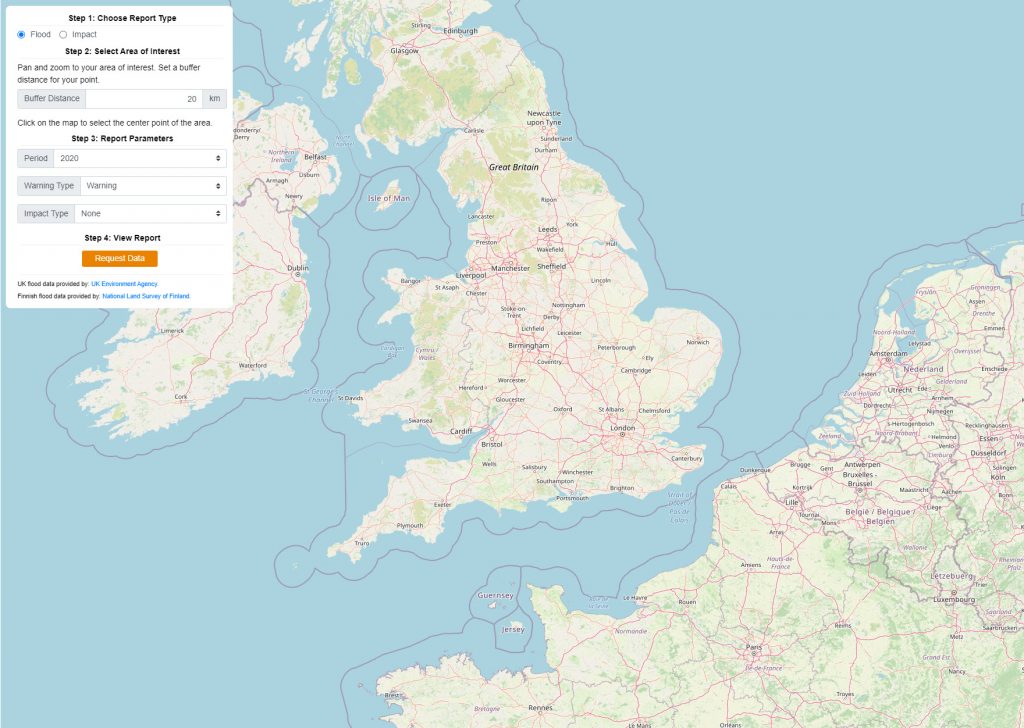
The app displays current and past flood extents and assesses their potential impacts on roads and infrastructure. The data is sourced from:
- INSPIRE themes
- National datasets and real-time, event-based warning services from the UK environmental Agency REST service
- The National Land Survey of Finland (OGC API Features) historical flood database
- UK Ordnance Survey OpenData products (OS Mastermap GML) infrastructure information
The workflow is powered by FME. Read more and learn to build your own by following our tutorial.
Ultimately, we all stand to benefit from any cause that opens the door for meaningful, democratic, and sustainable action. Geospatial data is instrumental for understanding and adapting to our environment. When we have access to information and have the means to use it, we’re empowered.
Staying INSPIREd
Considering the diversity of methods, tools, and technology involved with collecting and recording geospatial data for environmental applications, there will continue to be challenges for getting everyone on board with INSPIRE and supporting the SDI as it evolves. Legacy systems, proprietary formats, and ever-changing technologies will likely continue to play an important role in our workflows. And that’s OK, because it hasn’t stopped us at Safe Software before. We’re somewhat of an equal opportunist when it comes to data formats, so we welcome INSPIRE data to the party.
These days, improving support for alternate encodings is topical in the INSPIRE and OGC communities. Given some of the challenges of working with XML/GML, especially for web and mobile applications, there is a strong appetite to augment INSPIRE by adding support for HTML, JSON, GeoJSON and REST APIs for web services.
INSPIRE GML will continue to be a major player in the world of comprehensive data models and exchange, but these lighter weight encodings will allow for an even wider range of applications. FME recently added support for OGC API Features. This is in addition to support for REST APIs, JSON and GeoJSON, so you’ll be able to work with all forms of INSPIRE encodings as they evolve going forward.
At Safe, it’s our mission to solve data challenges. We’ve been following Europe’s INSPIRE directive since the beginning, supporting our users by making it easy for them to connect and integrate INSPIRE data into their workflows.
To learn more about FME, download a trial for free! Or, visit the following resources for more on FME and INSPIRE:
- EU INSPIRE Initiative Tutorial
- European FME Partners for INSPIRE Services
- INSPIRE Solution Pack for FME
- 5 Tips for Providing Data to Europe’s SDI
- Efficiently Implementing INSPIRE & Creating INSPIRE Mashups
- INSPIRE Success Stories with FME

Sanae Mendoza
As part of the FME Server Technology Experts team, Sanae’s goal is to help get your data working for you. Offline, she enjoys getting inspired by baking shows, repurposing fabric for sewing projects, and finding new spots to camp.


