
Ever Realer: Minecraft Data Styling at Brecon Beacons

Hay-on-Wye is a book lover’s paradise. Located in the Brecon Beacons National Park in Wales, it’s also the location of a new FME-driven Minecraft project – and I must say it’s a beauty.
Shaun Lewis, GIS Analyst at the Brecon Beacons National Park Authority has been constructing and refining the world, with a similar purpose to many Minecraft initiatives we’ve seen – that of engaging young people in the planning process.
The difference here is the level of detail in styling the world – and Shaun and Paul Funnell, Project Manager have generously shared their approach with us, as well as some tips that may help you style your own Minecraft world with an eye towards realism, aesthetics, and clarity.
The Basic Build
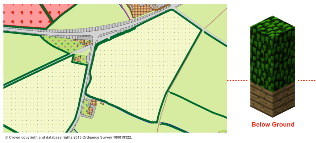
Source data for the world came from a few different providers. The majority is derived from Ordnance Survey’s MasterMap, including roads, buildings, woodlands, water features, and private lands and gardens. Natural Resources Wales was the source for more detailed information on arable land and trees within the town. And the Local Development Plan – the focal point of the project – included an in-house dataset covering items like public right-of-ways, conservation areas, community use land, housing allocations, and industrial estates.
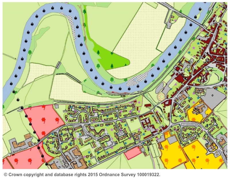
To prepare, these vector datasets were draped over a LiDAR-generated digital terrain model. They also used the DTM to calculate building heights, by subtracting it from the coincident digital surface model (also provided by Natural Resources Wales), and clipping the results to the OS building footprints.
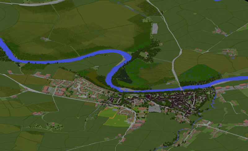
Shaun’s workspaces take care of the draping and adding of 3D, styling, and transformation to a Minecraft point cloud. They’ve kept the world at actual scale, where 1 block = 1 cubic meter, and maintained the British National Grid coordinates so you can teleport to known locations in the real world.
Styling
Most styling decisions when going to Minecraft are relatively straightforward materials assignments – cobblestones for paths, spruce saplings for coniferous woodlands, brick for buildings, and so on. And once in the world, you can enhance and edit to your heart’s content.
Shaun and Paul decided to automate as much as they could in the workspace, and that involved coming up with some rather creative solutions to styling. Here’s a few examples.
Beacons as Boundary Indicators
Styling is done by assigning attributes to points. Minecraft recognizes blockID, blockData, and _vertical_offset values, assigning materials and positions accordingly.
The park boundary is an important piece of information, but they didn’t want to show it as a solid line in the world. So they sampled the boundary vector, creating points every 50 meters, and styled them as beacons.
A Stroll Through the Forest
Wooded areas were mapped as polygons in the original data. And so if each point (1 meter cube) in the Minecraft output were styled as a tree, the forest would be so dense that users wouldn’t be able to walk through it.
The solution here came from advice from Safe’s in-house Minecraft expert Dmitri Bagh. By using an expression within a PointCloudExpressionEvaluator to randomize the planting of saplings, approximately 1 in 10 blocks have trees placed on them. This creates a more natural-looking distribution and leaves plenty of space to walk through the wooded areas.
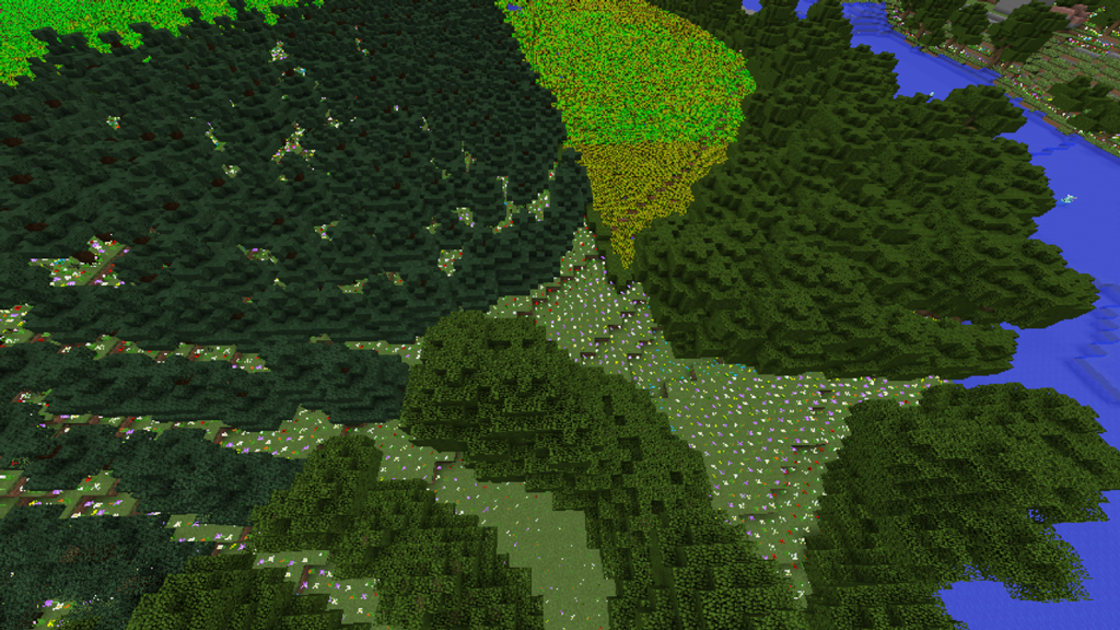
The same expression evaluation technique is used to assign random flower types to the remaining blocks, creating varied ground cover between the trees. One note to keep in mind when planting things in Minecraft – they need something to grow from. The zero-offset blocks are assigned a grass type (dirt works as well), and then the flowers and trees are placed on it at a vertical offset of 1.
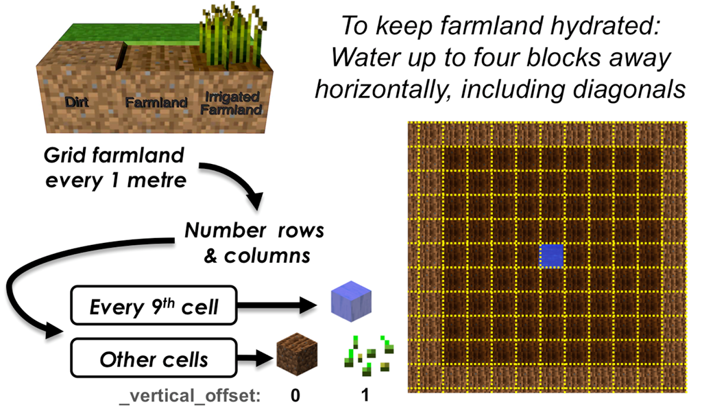
Minecraft Rules: Watering Arable Land
In some cases, the rules of a Minecraft world will dictate (and complicate) styling choices. In order for crops to grow on farmland, it needs to be watered. This can be done by placing a well within four blocks of a farmland block – in any direction including on the diagonal.
To deal with this, Shaun generated a one-meter grid within each farmland polygon, numbering the rows and columns. From there, he sampled every ninth cell – and added a well to it. The remaining blocks were styled as farmland with a seed.
Style Invention: Creating Hedgerows
To add some aesthetic appeal and visual definition to the fields, they decided to place hedgerows around the boundaries of fields larger than 15 hectares and farmlands, leaving gaps for right-of-ways and footpaths. But Minecraft didn’t have a hedge block.
The solution here was to make one. They stacked 2 blocks of oak leaves vertically (using the offset parameter), which solved the visual part of the problem. But oak leaves will decay if they aren’t within five blocks of wood – and so they sunk a wooden block under the ground, with an offset of -1, to keep the hedge green and alive.
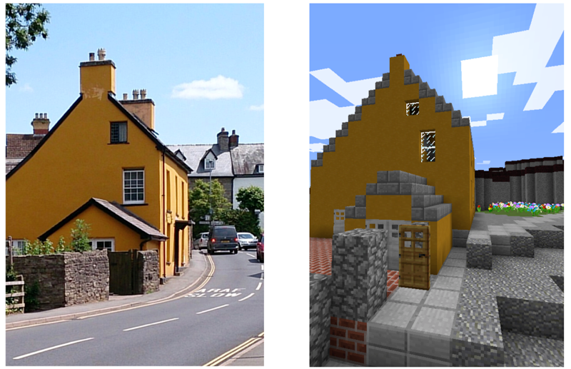
In-World Editing: Virtual Community Involvement
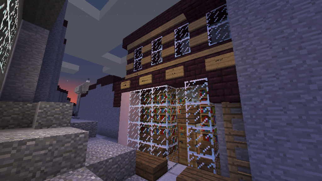
While preparing for the wider release of the world, the team has already brought in young people to start applying realism. With photographs, Google Street View, and feet on the ground, they have started editing the generically styled structures to match their real-world appearances.
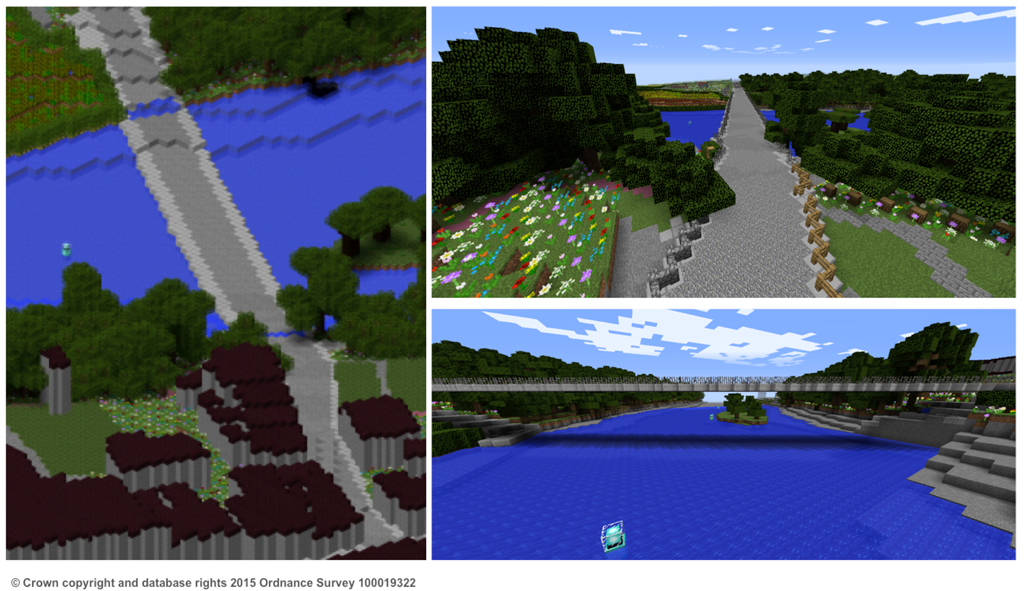
Bridges are an excellent example, where the 2-D source data didn’t differentiate the elevation of the structure and the underlying river. World participants have gone in and raised it to actual height.
Shaun shared his thoughts on working with FME for this project. “Since FME is a dynamic workflow tool, we were able to quickly and easily add more datasets and tweak the workflow to improve results. Because it’s so flexible, we were able to ‘run wild’ with our imaginations. We were also able to make a few quick adjustments and run the workspace for other parts of the National Park. There’s no doubt about it that I became addicted to using FME for the project – and because of this, I am now much more experienced with it and I’m sure we will be using it for more complex and innovative projects in the future.”
“We’ve been really delighted by the results achieved so far, both in terms of the quality of the world FME allowed us to build and the reception it’s had from everyone we’ve shown it to,” says Paul. “We believe this approach provides us with all kinds of opportunities for innovative engagement, not just around land use planning but also heritage, archaeology, understanding ecosystems services, and in general terms achieving a greater appreciation of this wonderful place that we’re so fortunate to live and work in.”
Want more Minecraft and FME?
FME Knowledge Center: How to make Minecraft worlds
Recorded Webinar: Geospatial and Minecraft – Why You Should Care
Explore more blog content headline

Data-Driven Marine Operations: 5 Ways to Generate Actionable Insights from Ship to Shore


Introducing FME Form 24.0: Redesigned User Experience for Focus and Consistency


[New!] AI Assist in FME: How to Build Better Data Integration Workflows with the Help of AI